This collection of satellite images was transferred to the European Centre for Space Records from the Earthnet Office and from the personal collection of Maurizio Fea, who held positions in various Earth observation roles throughout his career at ESA. These included responsibility for the development of the ground infrastructure for data management of ERS-1 and, as Head of the Training and Promotion Section of the Earth Observation Applications Department, for applications and training on the use of satellite data for Earth observation. His collection of images was certainly a valuable resource for the many events in which he was involved, ranging from the UN/ESA train the trainer programme in Earth observation to outreach events with school groups.
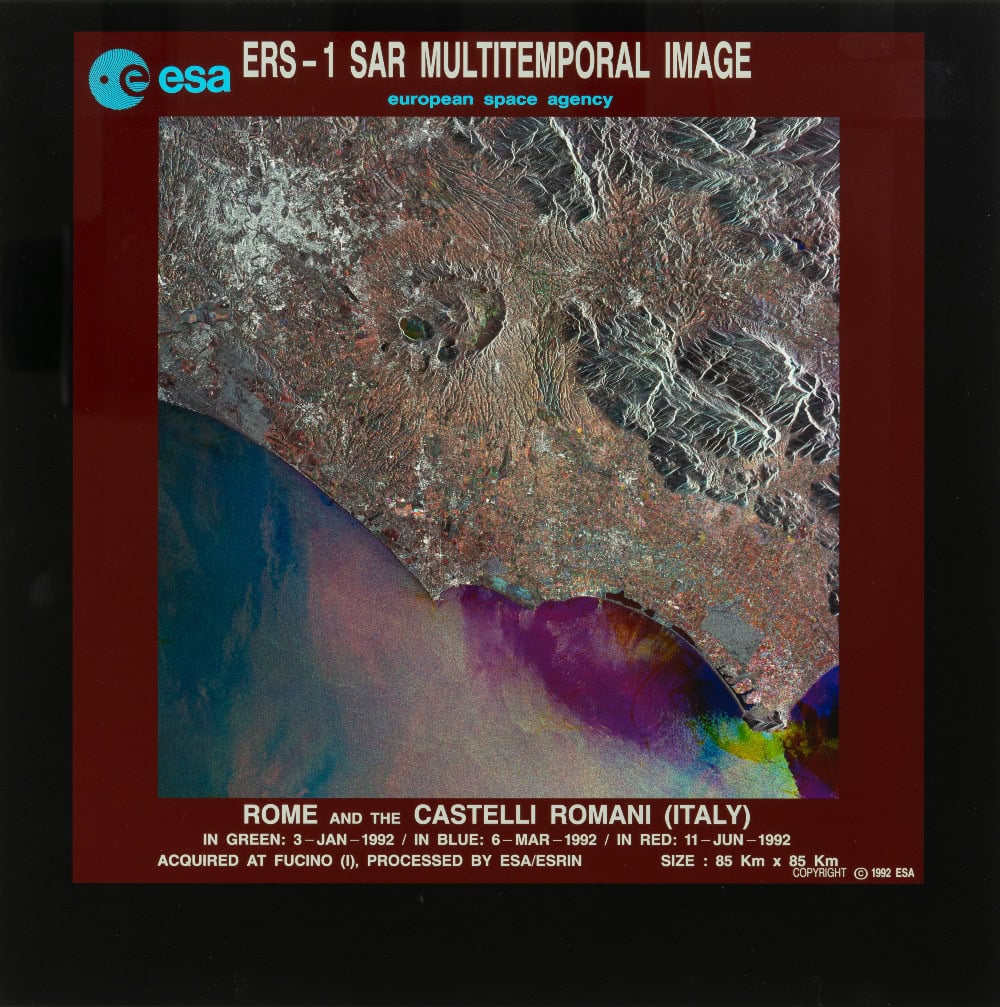
The majority of the collection consists of SAR multi-temporal images captured by the ERS-1 satellite, the first environmental monitoring satellite developed by ESA. The SAR (Synthetic Aperture Radar) technique allows users to obtain high-resolution radar images from large distances, such as from space. Multi-temporal images are combined imagery of multiple images of the same place or location taken at different points of time, which can be used to identify changes in a landscape.
However, the collection also contains about ten images, captured either in addition to, or by ERS-2. The first images produced by the ERS satellites were disseminated as transparencies, either in positive or negative, and these form the basis of this ECSR analogue collection.
The digital collection now available in SHIP consists of a selection of approximately 100 of these transparencies from the full analogue collection. It covers the period from 1991 to 1997. The collection is arranged in six series, according to year. Some of these series contain both positive and negative transparencies of the same capture, for example the Bay of Naples (1991), Venice (1992) and Rome and the Castelli Romani (1992), along with some duplicate images that lack the border containing information on location and date. All of the prints were digitised and in cases where there was more than one print of the same image, the decision was made to keep the duplicate images, to maintain the integrity of the original physical collection. In the same way, the prints were digitised exactly as they are, including some images with black masking tape.
Together with the other printed space data held in the ECSR, this collection represents the first chapter in the mapping of the globe through ESA’s Earth observation missions.
To browse the collection of ERS satellite images, enter the SHIP database and search for ‘ERS-1’.
Once you have selected a series, SHIP’s image viewer allows you to select your preferred viewing mode for the documents in it by clicking the 'image viewer' icon on the right of the top header bar.